The Big Ending
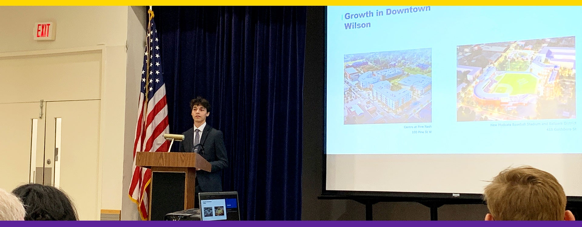
Eight BS in Community and Regional Planning program students successfully presented their capstone practicum projects from PLAN4099: Planning Practicum (instructor: Prof. Merrill Flood, Planner-in-Residence) on April 30, 2024, at ECU’s Willis Building. All undergraduate Planning students must complete two client-based community research projects during their senior years: as a small group in PLAN4096: Planning Studio (Fall semesters) and an individual in PLAN4099: Planning Practicum (Spring semesters). They must present in front of jurists, composed of all planning faculty, the Planning Alumni Advisory Board members, community partners, and other invited planners locally. The Community and Regional Planning program wants to share our deep appreciation to all community partners, project sponsors, and jurists for their willingness to guide these emerging planners.
 Cameron Brown presented the “Pitt County, North Carolina, Industrial Site Study (project sponsor: Merrill Flood).”
Pitt County, North Carolina, boasts a diverse industrial landscape, ranging from pharmaceutical manufacturing giants like Thermos Fisher to industry leaders in advanced manufacturing such as Grady-White Boats. While historically tied to tobacco, Greenville has evolved into a thriving community fueled by the presence of East Carolina University (ECU) and its robust economic impact. Pitt Community College also plays a pivotal role in the county’s success, serving as a vital source for workforce development. However, despite its economic strengths, industrial growth in Pitt County has encountered challenges since 2010. Despite being an economic hub for neighboring counties, the county has experienced a slowdown in growth.
Nonetheless, Pitt County continues to draw from a large labor pool, attracting residents from surrounding municipalities and contributing to its vibrant workforce. Statewide, however, North Carolina has seen an economic boom with billions of investments coming into the state. Doubled the number one state for business two years in a row by CBNC, North Carolina has been recognized as a manufacturing powerhouse in the south and continues to lead in the rate of GDP growth as the state has the eighth highest GDP growth rate in the United States. Much of this growth has been seen as companies continue to move to and expand within the state. Due to this economic success, however, the state has seen record demand, which has been attributed to the number of sites within the state being depleted. The North Carolina Economic Development Partnership reported that out of the 85 projects North Carolina lost, 34% of 29 projects were due to the lack of suitable buildings/sites. More than double the next two reasons, which were outside of the search area (15%) and Proximity to Supply/Chain Customers. The report recommends three strategic recommendations for Pitt County based on the secondary data analysis, case studies, and surveys from key stakeholders in Pitt County.
 Johnathan Alberg completed the “Wilson Five Points Small Area Plan (project sponsor: Wilson Planning & Community Revitalization office).”
Designed over a two-and-a-half-month period in early 2024, the Wilson: Five Points Small Area Plan strives to uncover local points of interest in the Five Points neighborhood of Wilson and develop solutions and recommendations on how the neighborhood can solve those issues and grow in a smart, attainable way moving into the future. With downtown Wilson growing, new developments are infringing on the Five Points area. In conjunction with Wilson’s new comprehensive land use plan, Wilson Growing Together (2024), City Staff within the Planning & Community Revitalization. The department sees the need for a specialized plan for the Five Points neighborhood.
This small area plan looks at the existing conditions to determine goals and recommendations, along with providing examples of those goals and recommendations in action. The plan emphasizes three major characters to the area: Park space that offers a variety of vegetation and open space for recreational purposes and community events. Apartments are to be located along the main roads of Downing St., Fairview Ave., and Goldsboro St., and mixed-use apartments at the intersection of Downing St., Fairview Ave., and Goldsboro St. (Five Points). Five recommendations include 1) promoting the addition of affordable housing, 2) encouraging a mixture of housing types, 3) supporting the growth of and establishment of local businesses, 4) encouraging reinvestment and rehabilitation of existing structures, and 5) creating a cohesive community feel and identity.
 Riley Jacob’s project was “Town of Stantonsburg Wayfinding and Signage (client: Town of Stantonsburg).”
The proposed wayfinding and signage plan for Stantonsburg, North Carolina, is a comprehensive strategy aimed at enhancing navigational clarity and showcasing the town’s unique features to both residents and visitors. Developed through a meticulous approach that integrates technical precision, public input, regulatory standards, and best practices, the plan addresses immediate needs while laying the groundwork for future expansion onto highways and downtown revitalization.
Key components of the plan include a detailed scope of study encompassing preexisting signage, regulations, and specifications, as well as a thorough project outline identifying clients, goals, data resources, and implementation strategies. Emphasizing the importance of enhancing visitor experiences, enforcing community culture, and showcasing essential structures and highways, the plan proposes various sign types, including directional, informational, pedestrian, landmark, safety, and historical signs, to ensure efficient navigation and enrich the overall experience.
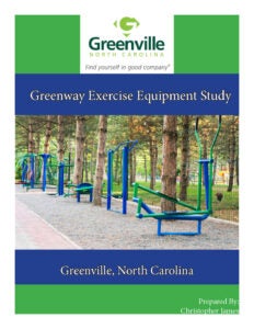 Christopher James completed the “Greenway Exercise Equipment Study, Greenville, NC (client: Greenville Parks and Recreation Department, Greenville, NC).”
The Greenway Exercise Equipment Project was to research and develop a plan to create outdoor fitness gyms along the greenway that goes throughout the city of Greenville, North Carolina. The project’s intention is to enhance Greenville’s greenway system to give users a higher quality and more dynamic experience. Fitness within a community can influence many different aspects of individuals’ lives, such as physical health, mental health, social activity, and community engagement. Outdoor fitness gyms reflect the commitment to giving the community a higher quality of life and the ability to enjoy fitness in nature. The goals of the project were to redefine the opportunities for exercise that the greenway has to offer so that the community has free and accessible workout equipment to use, place the outdoor gyms in locations along the greenway that have the most foot traffic to conveniently accommodate the community, use the public engagement feedback to select the best and most practical equipment to place along the greenway, and get the project passed by the Greenville local government to ensure funding and implementation of the outdoor gyms. Throughout the project’s research phase, there were many different outdoor fitness equipment companies to choose from. The goal of our decision-making process was to find the best quality equipment at a fair market value so a variety of equipment could be placed at each gym location. The budget we set for all 3 locations came in at $45,000, and we were able to find multiple different funding sources to apply for and anticipate being able to get the money from them.
 Mary Archibald’s project was with the Habitat for Humanity of Goldsboro-Wayne, Inc. (client) on “McNair Heights Housing Development: Building Community and Opportunity.”
The proposed multi-unit housing development project in the McNair Heights neighborhood by Habitat for Humanity of Goldsboro-Wayne in North Carolina marks a significant endeavor aiming to address the community’s housing needs while fostering inclusivity and empowerment. Demographics have shown that the community is considered low-income and fosters a significant African American and Black population. Much of the surrounding area is owner-occupied, and through community engagement, it was discovered that the neighborhood currently lacks resources to foster success. Through the engagement, it was discovered that resources such as grocery stores, daycare facilities, transportation, and police support were desired. However, the overwhelming favorite was not a physical location but a sense of belonging, engagement, and investment in the community. A community center has arisen as the best possible outcome for the commercial property. Along with this, a set of neighborhood initiatives and principles is needed to create a thriving neighborhood. This includes safety-integrated principles, open space, and an online platform for the proposed neighborhood. Through amalgamating data-driven insights, community engagement, and strategic guidance, Habitat for Humanity should be equipped to enhance the success of the McNair Heights development, creating a vibrant and inclusive neighborhood for generations to come.
 Noah Mills developed a project titled “Lake Glenwood Project (client: Pitt County Planning Department and Engineering Department).”
Pitt County acquired Lake Glenwood at the request of the Homeowners Association due to the lake’s deteriorating dam on January 15th. The Pitt County Board of Commissioners accepted the donation of Lake Glenwood and about 2.5 acres of property adjacent to the lake for recreational use.
Based on the surveys from the residents near the site, the project recommends several recreational facilities for the site. These include a floating fishing pier/kayak launch, a walking trail, a picnic area, and parking for visitors. Various funding sources were explored.
Will Lowery’s project was the “Fountain Downtown Parking Study (client: Mid-East Commission, North Carolina).”
 The Parking Study investigated 1) The existing public parking capacity in the study area, 2) potential parking availability for the study area, and 3) the parking solutions. The town requested these items because they wanted to know the parking availability. The town wishes to address the challenge of not knowing the exact parking inventory and how much inventory is available. The town is pursuing the idea of re-establishing the music festivals of the past. In previous years, the town has hosted bicycle events and wishes to pursue more events of a similar nature.
The research conducted field observations of public lots, potential parking lots, and sidewalk availability and conditions. A resident survey was also conducted to understand how the town’s residents utilize the current parking supply, the methods they use to travel to the study area, the purpose of their visit, and which parking method they prefer.
This study suggests six recommended items. Although each item is offered individually, the town should consider combining them for efficiency and tremendous success. They are signage improvement, maintenance of surface lots, utilization of additional parking lots, road diet on North Jefferson Street, on-street parking improvements, and sidewalk upgrades.
 Isabella Sardina expended her research interests and completed a project about “Town of Tarboro’s Flood Land Reuse Plan (client: Town of Tarboro, NC).”
Throughout history, the Town of Tarboro has experienced highly impactful flooding events. As one example of a more recent event, the torrential rains produced by 1999’s Hurricane Floyd caused flash flooding in Tarboro and surrounding areas, including Princeville and Rocky Mount. Rivers and streams flooded nearby roads and communities, and more than 60 single-family homes and over 50 multi-family homes were lost in the flood hazard area.
In 1999, the Federal Emergency Management Agency (FEMA) acquired and elevated properties impacted by Hurricane Floyd under FEMA’s Hazard Mitigation Grant Program (HMGP). Then, in 2016, Hurricane Matthew brought about a second wave of buyouts due to losses sustained from flooding. In total, FEMA acquired 54 Tarboro properties through this program.
The FEMA HMGP program provides individuals and families whose homes are impacted by flood events with the opportunity to relocate from flood-hazard areas. Tarboro must now determine how to use the acquired lands within constraints imposed by FEMA regulations.
The report provides recommendations for authorized reuse of the properties, with strong consideration for the Tarboro community’s wants and needs, as determined by various research methods such as community surveys and conversations with key stakeholders. The project recommends 1) leasing adjoining property owners, 2) creating a community garden, 3) open/unbothered space, and 4) additional greenway/park space for the properties within the study area.
